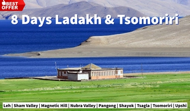
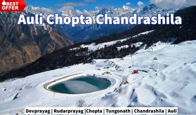
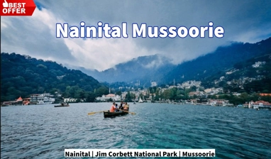
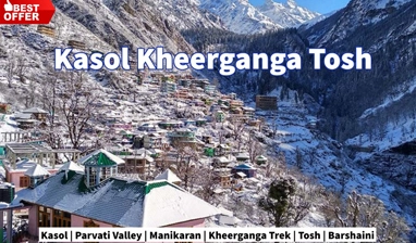
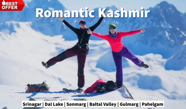
Tour Highlights
Wheels of a car roll you around the world on the smooth roads, and you can rock, but your legs move you to the toughest terrain created on the rocks. Trekking is the best way to explore the unexplored and know about the places which are away from the reach of a common traveller. When you trek, you pass through some of the most beautiful landscape on this planet which remains hidden from the rest of the world. Trekking requires a certain level of physical fitness and the traveller has to be prepared to encounter some unusual situations, such as steep hikes, long walking days, descends on loose rocks, dense forests, crossings the rivulets, and remaining away from the civilisations. We encourage you to keep the fire in belly to visit the unknown and we organise the treks to the remotest parts of the Himalayan regions.
![]()
These treks are designed for the beginners and also for those who have less time. Just want to feel nature in your hands and be with it, buy one of these products listed below and relish yourself.
For more information please call us at: (+91) 78310-50555, (+91) 98163-50555
Medium Treks surely take to the core of nature. You could be away from the world, camping in the middle of the forest, or sleeping in your tent pitched in the wilderness on a meadow. At dawn a thrush tweets from a nearby shrub or the silvery rays encourage the wind to make the flap of your tent flutter.
For more information please call us at:(+91) 78310-50555, (+91) 98163-50555
Have courage to accept the challenge. Test your muscles and be ready to enjoy the nature to its fullest. You are above the treeline and in a world inside the world. The snow peaks dominate the region, the mountain deserts surround you, the high altitude lakes bait you, the remote villages attract you and the presence of a snow leopard or a griffin might encourage you to pull out your camera to shoot them.
For more information please call us at: (+91) 78310-50555, (+91) 98163-50555

Duration: – 1 Night & 2 Days Grade: – Easy to Moderate Physical Level: – Intermediate Season: – March – November Locations: – Dharamshala and Bhagsu Nag Temple. Highest Altitude: – 9,278 ft
Day 01: McLeod Ganj – Triund
After breakfast start the trek. We start walking from McLeod Ganj via Dharamkot Village, a small semi-nomadic village inhabited by Gaddi Shepherd Tribe. The trail goes through a mixed forest of Himalayan Cedar, Rhododendron and Oak trees. Triund is situated on a ridge from where we have breathtaking views of the Dhauladhar Mountain Range to the north and Kangra Valley to the south. We camp at Triund for the overnight stay.
Day 02: Triund – Bhagsu Nag
After breakfast we start to descend taking a different route via Leta and Bhagsu Nag Waterfall. We finish our trek at the road head at Bhagsu Nag. End of services.
The above quote includes:
All trekking arrangements including sleeping tents on twin sharing (Alpine shape), sleeping mattresses, sleeping bags, toilet tents, dinning tent (in case of a large group), kitchen tent, English speaking mountain guide, cook, kitchen helpers, camp boys, Mules for luggage.
Meals (pack lunch + evening tea & snacks + dinner on day 01 and breakfast on day 02)
The above quote does not include:
Any bus, air or train fare before and after the tour.
Any Hotel accommodation before and after the trek.
Insurance of any kind (personal, medical, accidental etc.
Items of personal nature such as beverages, laundry, phone bill, tips etc.
Emergency evacuation charges (if any).
Portage at railway stations and hotels.
Anything that is not mentioned under the “quote includes” head.
For more information please call us at: (+91) 78310-50555, (+91) 98163-50555

Duration: – 3 Nights & 4 Days Grade: – Easy to Moderate Physical Level: – Intermediate Season: – May – October Locations: – Manali, Solang Valley, Dhundhi and Bakerthatch. Highest Altitude: – 12,772 ft
Day – 1 Manali to Solang 2450m (3 to 4 hrs)
After breakfast an easy walk to Valley Solang through village Old Manali, Goshal, Shanag and Burua. It is a beautiful easy walk through apple orchards along with the above mentioned villages. On the way one can see or observed the local village life of Manali valley. And will have spectacular views of Kothi, Gulaba and Rohtang Peak. On arrival at Solang camp site hot lunch will be provided. After evening tea acclimatization walk towards Shivling Points 2650m. Overnight stay in camps
Day – 2 Solang to Bakarthatch 3150m (4 to 5 hrs.)
An early starts to the Bakarthatch camp after breakfast with pack lunch. Today it will be an easy trail to Dhundi about 6km along with the Beas River. After Dhundhi a moderate trek to the camp at Bakarthatch. On the way we will cross a temporary bridge and will walk the other side of Beas River all the way to the camp. Bakarthatch is a place where we can observe shepherd groups along with their sheep’s and goats and beautiful views of Mount. Hanuman Tibba 5980m, which is the highest mountain of Dhauladhar range. After evening tea a brief lecture on surrounding mountain ranges and fauna & flora.
Day – 3 Bakarthach – Lake Beas Kund hike 3690 (5 to 6hrs)
An early starts from the camp after Breakfast with pack lunch to the lake Beas Kund. Today it will be a moderate trek through gentle mountain ridges and Beas kund glacier moraines. Moraines are the part of glaciers, in which you will see different kind of rock boulders and ice features in it. After negotiating the moraine field, about an hour to the lake. On the way we will have the spectacular views of Mount. Shitidhar (5260m), Freindship Peak (5350m), Seven sisters peak (4650m)Laddakhi Peak (5390m), Manali Peak (5560), Kullu Peak (5450), O peak (5130m) and Hanuman Tibba (5980m). In evening camp fire at camp.
Day – 4 Bakarthatch to Manali (4 to 5 hrs.)
After breakfast we will trek till Solang valley and from there 30 minutes drive to Manali and departure.
The above quote includes:
All trekking arrangements including sleeping tents on twin sharing (Alpine shape), sleeping mattresses, sleeping bags, toilet tents, dinning tent (in case of a large group), kitchen tent, English speaking mountain guide, cook, kitchen helpers, camp boys, Mules for luggage.
Meals ( 04 pack lunch + evening tea & snacks + 03 dinner and 03 breakfast)
The above quote does not include:
Any bus, air or train fare before and after the tour.
Any Hotel accommodation before and after the trek.
Insurance of any kind (personal, medical, accidental etc.
Items of personal nature such as beverages, laundry, phone bill, tips etc.
Emergency evacuation charges (if any).
Portage at railway stations and hotels.
Anything that is not mentioned under the “quote includes” head.
For more information please call us at: (+91) 78310-50555, (+91) 98163-50555

Duration: – 3 Nights & 4 Days Grade: – Easy to Moderate Physical Level: – Intermediate Season: – All year Around Locations: – Shimla, Mashobra , Deola and Khatnol Highest Altitude: – 9,423 ft
Day – 1
Drive to Mashobra, the first day of your trek descends down Mashobra valley for two hours,passes through old Cedar forest and Himalayan hamlets on the slopes with lush green terrace fields. A demanding uphill on the south face of the valley exposes wide views as we walk through the meadows. Finally reach your Home Stay by the side of Deola village at the base of Shali peak. Stay overnight in Home Stay. Duration of walk: 5-6 hours
Day – 2
After early breakfast, walk up to Shali peak, the highest peak in the vicinity of Shimla. A four hour of excellent Himalayan hike traverse through quant villages and a thick cedar forest before the wide panorama of snowcapped Western Himalayan ranges to the north and Punjab plains on the south becomes alive. Visit the ancient temple dedicated to Goddess Bhima-Kali, the only construction on the top of peak(3200mtrs). Later enjoy a well deserved packed lunch with 360˚ Himalayan views. After lunch, a three hour walk of descend bring us down to village, Deola. Stay overnight in Home Stay. Duration of walk: 6-7 hours
Day – 3
After breakfast, in morning, explore the village and walk through the traditionally built houses and a temple dedicated to local deity. Later walk down to Guma Water Pump Station & driver to Tatapani for overnight stay in Guest house. Duration of walk: 5-6 hours
Day – 4
After breakfast walk to Shiva Cave & then white water rafting in Sutlej River, one of the fast flowing rivers in the country. Afternoon drive back to Shimla.
The above quote includes:
Taxi from Hotel to Mashobra ,Guma to Tatapani &Tatapani to Shimla.
Local guide for 4 days.
2 nights’ accommodation in Home Stay with local family.
One night stay in Guest house in Tatapani.
Meals (04 pack lunch + evening tea + 03 dinner and 03 breakfast)
White Water rafting in Sutlej River for one hrs.
The above quote does not include:
Insurance of any kind (personal, medical, accidental etc.)
Items of personal nature such as beverages, laundry, phone bill, tips etc.
Emergency evacuation charges (if any).
Portage at railway stations and hotels.
Anything that is not mentioned under the “quote includes” head.
For more information please call us at: (+91) 78310-50555, (+91) 98163-50555

Duration: – 1 Night & 2 Days Grade: – Easy to Moderate Physical Level: – Intermediate Season: – All year Around Locations: – Barsheni, Kheerganga, Bhunter. Highest Altitude: – 9,700 ft
Day – 1
Reach Barsheni Village, Trek to Kheerganga: Trek to Kheerganga starts from the Barsheni, situated on the bank of Parvati River. After reaching Barshaini, your hiking will start. Trek starts with walking through the thick pine forests and then suddenly landscapes change into fields and villages once you cross an iron bridge over the raging stream .On the way to your trek, you stroll through the magnificent landscape of Himalyan Valleys. As you trek further to Kheerhanga from Kasol, you’ll find many waterfall. Later you arrive at Rudra Nag and take a small halt to see the beauty and capture it. This trek gives you the opportunity to Interact with the locals, and to know about their culture and lifestyle. Since
Day – 2
Kheerganga to Barsheni to Bhuntar: Get up early in the morning to enjoy the sunrise and cherish the view of the misty mountains. After a hearty breakfast at the campsite, pack up and get ready to trek back to Barshaini.
Kheerganga Trek Packages:
You will be staying in camps, overnight, in Kheerganga. Experience campfire, tents and sleeping bags, like never before, during this adventure. The music session to be organized at the campsite is the cherry on the top! During the upcoming holidays, plan a trip to Kheerganga and make your vacations extraordinary!
The above quote includes:
Local guide for 2 days.
1 night accommodation in tent.
Meals (02 pack lunch + evening tea + 02 dinner and 02 breakfast)
The above quote does not include:
Insurance of any kind (personal, medical, accidental etc.)
Items of personal nature such as beverages, laundry, phone bill, tips etc.
Emergency evacuation charges (if any).
Portage at railway stations and hotels.
Anything that is not mentioned under the “quote includes” head.
For more information please call us at: (+91) 78310-50555, (+91) 98163-50555

Duration: – 5 Nights & 6 Days Grade: – Easy to Moderate Physical Level: – Intermediate Season: – All year Around Locations: – Sankari, Uttarakhand. Highest Altitude: – 12,500 ft
Day – 1
Pickup From Dehradun and drive to Sankri: Your trip will start from Dehradun for the Kedarkantha Winter Snow Trek. All the trekkers need to arrive at Dehradun before 6 am because till 06:30 am, we will start our drive to Sankri. You need to know that the distance between Dehradun to Sankri is almost 220km which will take approximately 10 hours to reach. Sankri is located on the National Highway 123 and is a beautiful drive. While driving from Dehradun to Sankri, you will be spell-bounded with the beauty of valleys as well as forests.Before reaching Sankri about 22km, all the trekkers will get an amazing feeling of serene Himalayas as well as greenery. You will also come across Govind National Park which is well-known for its huge collection of Flora. In this park, you will find the Flora which is available only in this region and nowhere else in the country.
Day – 2
Trek from Sankri to Juda-ka-Talab: On day 2, you will begin the trek towards Juda Ka Talab which is located at an altitude of 9,100 feet. Till afternoon, you will cover almost 5km which takes 5 hours but this can also vary on the capability of the trekker. Get ready to experience the diverse adventures on the trail. While walking, ice and slush might bother you a little but the guides of TrekupIndia will help you out so don’t worry. The trek will start with a beautiful pine & maple forest that will further rise alongside the wildlife as well as pastures. As you trail upwards, you will spot some beautiful huts alongside the fields. While trekking, you will see a goliath lake on the left and thick pine & oak backwoods on the other side which is a perfect example of beauty. You will get the Luke warm water all around the lake and the rest water will be colder. In winters, you can see a sheet of ice instead of water, giving you an eye-catchy view. This lake also has a big natural tunnel that offers water to the villagers. Primarily, you will be climbing through the bridges and one of the exciting things about this trek is that you will find Himalayan Languor. You need to know that they are shy animals and hardly anyone gets the chance to see them. You might also witness boars, hares as well as martens in this region. Juda Ka Tal is a beautiful destination in the thick pine and oak forest. At night, you will be served with hot & healthy dinner. Your night stay will be scheduled in a camp where you can enjoy the beauty of Mother Nature’s lap.
Day – 3
Trekking from Juda-ka-Talab to Kedarkantha Base (Lohasu): Get up early in the morning and witness the breathtaking sunrise that will definitely leave you stunned. On day 3, we will begin the trek for Kedar Kantha base which is located at a height of 11,250 feet. Kedar Kantha Base from Jadu Ka Talab is almost 4kms and it takes 2.5 hours to cover at a moderate speed. You need to know that Jadu Ka Talab is a wonderful lake that is surrounded by pine trees that often gets freeze at the time of winters and also turns out to be a spot for adventures as well as fun activities for the trekkers. Gradually, the trail will get steeper as you keep on moving upwards. Your trek guide will teach you different skills for snow slopes, so be attentive and listen to him carefully. He might also guide you about how big your footsteps should be. Your trekking will again start from the dense forest of pine and oak trees. The trail also passes through the steep ridges. As you gradually walk towards the path and reach a height of 10,400 feet, you will witness the snow traces that will definitely give you magnificent views of nature. Get ready because the spectacular views are still waiting to shock the trekkers because before reaching the base camp all the trekkers can observe the stunning views of different arc-shaped ranges that are covered with snow like Bandarpoonch, Swargarohini, Kala Nag as well as Ranglana that are standing with great pride in the lap of Mother Nature. At night, you will be served with delicious dinner in your tents only..
Day – 4
Early Morning Hike From Kedarkantha base to Kedarkantha peak; descend to Hargaon camp: Day 4 is going to be a long one because you will be heading towards the Kedar Kantha peak. Today, you will be trekking from 11,250 feet to 12,500 feet and trek for almost 6kms which will be covered in 7 hours. It is necessary for you to know that the trail will be steeper, so be prepared accordingly. At the time of trekking, you will see the magical colors of nature as well as the majestic sights of different ranges including Rupin. The reason for calling it Kedar Kantha, rumors from villagers is; 1st they tried to build Kedarnath temple in that peak but they heard some animal’s sound which means omen for a divine event. Till then they constructed Lord Shiva’s statue till neck ad in Hindi neck is called Kanth as well as Lord Shiva has a lot of names and Kedar is one of them. This is the reason, why it is known as Kedarkantha. In Kedar Kantha peak, you can treat your eyes with appealing views of Bandarpooch, Swargarohini, Kalanaag, Gangotri as well as Yamunotri. After reaching the summit, the captivating views of nature will definitely balance your emotion and leave you stunned. On the top, you will also find a small temple which is dedicated to Lord Shiva and Goddess Parvati along with a small shrine of Lord Ganesh too. Apart from this, we will also start descending to Hargaon camp on the same day. A night stay will be scheduled at the campsites, giving you beautiful views of valleys and nature.
Day – 5
Trek from Hargaon camp to Sankri: Day 5 is marked for descending further to Sankri from Hargaon Camp. We will be descending from 8900 feet to 6400 feet. The time for descending the 6kms long trail will take almost 4 hours and even more if you follow a moderate speed. The day has arrived when you need to leave the regal views of the Himalayas as well as snowcapped mountain ranges because we will be heading back to Sankri. It is important for you to know that the trek is going to simple as the distance is short. Sankri is the stoppage village for several treks like Bali pass, Borasu pass, and many more. The morning at Hragaon camp is going to welcome you with a stunning sunrise right between the pine trees. After having breakfast, you will pack your back and start descending through a clearly marked paved pathway and reach Sankri.
Day – 6
After Having Last tea, coffee with us, Departure from Sankri to Dehradun: On day 6, you will be heading towards Dehradun from Sankri which will take almost 10 hours as you need to cover 220km. You will be leaving Sankri early in the morning so that by evening you reach Dehradun. By 7 – 8 pm in the evening, you will be reaching Dehradun, so get your bookings done for your hometown accordingly. Make sure to collect all your memories while driving back to Dehradun..
The above quote includes:
Local guide for 5 days.
5 night accommodation in Hotel/tent.
Meals (06 pack lunch + evening tea + 05 dinner and 05 breakfast)
The above quote does not include:
Insurance of any kind (personal, medical, accidental etc.)
Items of personal nature such as beverages, laundry, phone bill, tips etc.
Emergency evacuation charges (if any).
Portage at railway stations and hotels.
Anything that is not mentioned under the “quote includes” head.
For more information please call us at: (+91) 78310-50555, (+91) 98163-50555
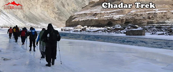
Duration: – 7 Nights & 8 Days Grade: – Difficult Physical Level: – Intermediate Season: – All year Around Locations: – Ladakh. Highest Altitude: – 11,100 ft
Day – 1
Reporting day at Leh: You will be landing at the Leh airport which is one of the most picturesque airports that you would come across. Just before touchdown time, you’ll be greeted with the entire range of snow-capped peaks that will surely get you wonderstruck. It’s important to keep your warm clothes handy as you’ll feel the sudden drop in temperature as soon as you arrive at the Leh airport. A jacket, woollen gloves, and a woollen cap are a necessity. After reaching the guesthouse you will be given enough time to relax and acclimatize to the conditions. Later in the evening, you can spend some time at the Leh market for any last-minute shopping. It is very important that you get used to the cold temperature in Leh because the temperature will only tend to fall as you start walking on the frozen Zanskar. From the end of January to mid-February, the temperature can be anything between -10 to -15 degrees during the day. It is also important to keep your body hydrated by increasing the intake of fluids that will help to maintain your body temperature.
Day – 2
Acclimatization Day: Keeping in mind the health problems that trekkers are facing (AMS), as per the new regulations applied, anyone doing the Chadar Trek should spend at least two days in Leh to get their body fully acclimatized to the weather conditions. It is irrevocable and it is important that it is strictly followed by every trekker. You can spend the day visiting the places around the city. You can also join us while we conduct a small sightseeing session (included in the cost). It is only for 3-4 hours, covering all the major spots of Leh. It is advisable that you avoid visiting places that are at a higher altitude. Crosscheck your essentials before going to bed.
Day – 3
Medical Test Day: Today is the big day. This day decides whether you continue further or not. Wake up early and reach the Govt. Medical Camp as early as possible. Even though tests take less time, due to tourists rush it gets delayed. In the late afternoon, we shall finish insurance formalities, if any. Your test results are your green card as to whether you will do the Chadar Trek or not so, in case the tests declare you are not fit to go for the Chadar Trek, you will not be allowed..
Day – 4
Leh to Shingra Koma drive then Trek to Tsomo Paldar: On this day, you’ll be headed to the first campsite which is Tsomo Paldar via Chilling & Shingra Koma. Shingra Koma is one of the most unique places in Chadar for it is placed at the U bend of Zanskar, forming a wonderful place with lots of views. Today will be one of the most scenic drives which let you witness some of the top spots in Ladakh. Gurudwara Pathar Sahib, Magnetic Hill, and the confluence of the Zanskar and Indus are some of the places where you can make a pit stop for clicking pictures 3-4 hours drive along the Zanskar will get you to Shingra Koma. The car will drop you right where the road ends, this will be your starting point of walking on the Zanskar. The layer of Chadar may seem thin here, you can also see various rock formations. Walking with gumboots on will definitely be a challenge in the initial stage. Understanding the ice patterns will take time, slowly but steadily you will know which surface is fragile and which is trustworthy. There are multiple ice surfaces that you would come across while walking on the mighty Zanskar. Planting your foot will be important in most cases, you can check for the ice for its steadiness with your walking stick before stepping on it completely. A small and light backpack will help you to manage your body weight in an effective manner. After an hour and a half of walking on the icy surface maintaining your balance you’ll be reaching your first campsite at Tsomo Paldar. This will be your first experience of camping under sub-zero temperatures.
Day – 5
Tsomo Paldar to Tibb Cave: Chadar is one such trek where you do not gain altitude in quick succession. Slowly but gradually from Tsomo Paldar to Tibb Cave (6-7 hours), you will be gaining an altitude of 400ft. (Tsomo Paldar: 11,400 to Tibb Cave: 11,800). After spending a cold night in the tent at Tsomo Paldar get done with your breakfast that will re-energize your senses in the morning. The much-needed hot cup of tea will be special in such frosty conditions. As you start heading to the next campsite which is Tibb Cave, you’ll see some of the most eye-catching frozen waterfalls. Waterfalls that stand frozen in time. The source of some of these frozen waterfalls is still unknown and there are a lot of myths amongst the villagers. The mighty Zanskar will be flowing all along with you on the trail and the emerald green water will have a soothing effect. You will be served lunch midway to Tibb Cave. After walking for a couple of hours you’ll come across different rock patterns along the way which look like art when the sun rays fall on them making their way from behind the clouds. You will be camping near the Tibb cave which is surrounded by dry sand.
Day – 6
Tibb Cave to Nerak: As you move on to the most awaited campsite of the trek which is Nerak, the 13 km long trail will take you to the most iconic landmark of the Chadar Trek the frozen waterfall. THe frozen waterfall is a nature's masterpiece that attracts trekkers from around the world. Hot lunch will be served on your way to Nerak. By far, Nerak will be the coldest of all the campsites on the trek where the temperature goes down to as low as -30 degrees during the night. It will be important that you wear proper clothing in layers to stay safe from the biting cold. If you manage to reach the waterfall on time, there are chances of paying a visit to the Nerak Village as well. You will be camping at a distance of 15-20 minutes from the waterfall.
Day – 7
Nerak – Tibb Cave: You might have heard stories of how unpredictable the weather patterns can get here on the Chadar Trek. There are instances where the formation of Chadar no longer exists on your way back from Nerak. In the same way, you will witness a new layer of Chadar formed some places. Even though it’s the same route, you’ll be amazed to see how different it appears while coming back.Chadar Trek is the experience of a lifetime that every trekking enthusiast should witness. And then, what if we told you that these eight days of your life are going to be some of the best days you have lived so far and that you will cherish these moments till the very end. Today retrace your steps back to Tibb Cave. You get another last chance to cherish, relive and gather the memories. Wave goodbye to all the locals while you make your way back. Be careful and enjoy your last stay in tents.
Day – 8
Tibb Cave to Shingra Koma then Drive to Leh: Again wake up early for a long walk back. It is not really retracing steps because you may observe a lot has changed. Chadar may have melted, a layer of Chadar may have gotten thin, and wonderful rocks are visible now. Well, that's the beauty of Nature and the Chadar Trek. Reach Shingra Koma and get ready to Board vehicles. Another bumpy ride and you will arrive in Leh.
The above quote includes:
Local guide for 7 days.
7 night accommodation in Hotel/tent.
Meals (08 pack lunch + evening tea + 07 dinner and 08 breakfast)
The above quote does not include:
Insurance of any kind (personal, medical, accidental etc.)
Items of personal nature such as beverages, laundry, phone bill, tips etc.
Emergency evacuation charges (if any).
Portage at railway stations and hotels.
Anything that is not mentioned under the “quote includes” head.
For more information please call us at: (+91) 78310-50555, (+91) 98163-50555
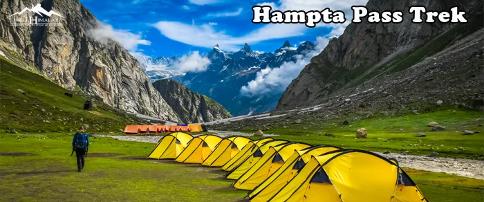
Duration: – Single Day Grade: – Easy Physical Level: – Intermediate Season: – All year Around Locations: – Himachal. Highest Altitude: – 14,000 ft
Day – 1
Arrive at Manali by 8.00 am. Drive to Jobra Roadhead, and Trek to Jobra: The base camp for the Hampta Pass trek is Jobra. The picturesque drive especially from Manali, along with 42 hairpin turns, has panoramic views of Kullu Valley. The Rani Nallah, which you will trek alongside till it disappears under the snow of Hampta Pass, starts accompanying you from here. From the road head at Jobra, the campsite is a 30-minute trek through a mixed forest of pine, bright green maple trees and luminescent silver birch.Cross the road where you get off from the vehicle and take the small path into the forest. The forest is mostly Pine with an occasional Maple tree with its new lush green leaves - a pleasant change in the vegetation. It's an easy slope and after 20 minutes into the forest, you come to a bend with a huge rock that overlooks a meadow strewn with small rocks.Camp in the meadows for the night to acclimatise better..
The above quote includes:
Local guide for 7 days.
7 night accommodation in Hotel/tent.
Meals (08 pack lunch + evening tea + 07 dinner and 08 breakfast)
The above quote does not include:
Insurance of any kind (personal, medical, accidental etc.)
Items of personal nature such as beverages, laundry, phone bill, tips etc.
Emergency evacuation charges (if any).
Portage at railway stations and hotels.
Anything that is not mentioned under the “quote includes” head.
For more information please call us at: (+91) 78310-50555, (+91) 98163-50555

Duration: – 3 Nights & 4 Days Grade: – Easy Physical Level: – Intermediate Season: – All year Around Locations: – Himachal. Highest Altitude: – 14,009 ft
Day – 1
Arrive at Manali. Drive from Manali to Gulaba Roadhead, and Trek to Jonker Thatch: The Bhrigu Lake trek begins at Gulaba. The 24 km route to Gulaba takes you on the Manali-Rohtang Pass road, past Kolang, Palchan and Kothi. You get fabulous views of pine forests and mountains as soon as you cross Kothi. Once a quiet hamlet, Gulaba is now buzzing with tourists in transit to Rohtang Pass. Vehicles drop you off at the road and head near the Gulaba check post. Trek steadily underneath forest cover, passing through open grasslands now and then. You will reach the Jonker Thatch campsite in about an hour and fifteen minutes.
Day – 2
Trek from Jonker Thatch to Rola Kholi: The trail begins with a steep ascent. Make note of brown oak, cedar and birch trees on the trail here. These are a few of the most prominent trees in the Himalayas. After around 20 minutes, the trail enters an open meadow where shepherds camp. Observe Mt Hanuman Tibba towering over the meadow in the background. Below Hanuman Tibba are the Seven Sister peaks seated in the Beas Kund Valley. Turn right from the upper ridge of the meadow and head south. The second forested cover begins here. Rola Kholi is a scenic grazing ground used by local shepherds. Located at the base of Bhrigu Lake, it makes for an ideal camping spot. The water source here is Chor Nallah, which flows across the camping ground.
Day – 3
Trek from Rola Kholi to Bhrigu Lake, and back to Rola Kholi: Start early as you have a lot of distance to cover today. You have to trek a height of around 1,348 ft to reach Bhrigu Lake. Bhrigu Lake rests between two high-altitude ridges. You begin with hiking to the first ridge, which is an hour away. In June, the trail is usually covered in snow. In July, as the snow melts on the lower reaches, you see the trail slowly turning from green to brown and white. As you reach the ridge, look for an oval glacial lake in the distance. Depending on the season, the lake is either surrounded by snow or fresh grass, along with alpine flowers. On a clear day, you can catch a stunning panoramic view of the Pir Pinjal and Dhauladhar ranges. Also, major peaks such as Indrasen, Deo Tibba and Hanuman Tibba stand majestically before you. The lake is normally enveloped in fog which can make finding the route tricky. It is always advisable to hire a local guide. After spending time at the lake, retrace your way to Rola Kholi.
Day – 4
Trek from Rola Kholi to Gulaba. Drive back to Manali: Today’s trek is an easy one. You get back to Gulaba through the meadows you came up from. The descent can be a bit steep but is good on your legs given you are always in the meadows. It takes 3-4 hours to reach Gulaba. Gulaba at around 9,875 ft is a better exit for your knees and feet as compared to Vasisht at 7,000 ft.
The above quote includes:
Local guide for 7 days.
7 night accommodation in Hotel/tent.
Meals (08 pack lunch + evening tea + 07 dinner and 08 breakfast)
The above quote does not include:
Insurance of any kind (personal, medical, accidental etc.)
Items of personal nature such as beverages, laundry, phone bill, tips etc.
Emergency evacuation charges (if any).
Portage at railway stations and hotels.
Anything that is not mentioned under the “quote includes” head.
For more information please call us at: (+91) 78310-50555, (+91) 98163-50555
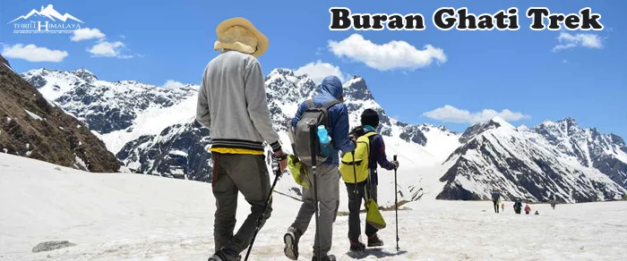
Duration: – 7 Nights & 8 Days Grade: – Difficult Physical Level: – Intermediate Season: – All year Around Locations: – Himachal. Highest Altitude: – 15,000 ft
Day – 1
Drive from Rohru to Janglik: The base camp of the Buran Ghati trek is Janglik. The drive from Rohru follows the blue waters of the Pabbar River. In an exquisite journey, the road climbs gracefully along the Pabbar, the scenery changing rapidly. From square wheat fields along the river and beautiful Himachali homes, you drive past pretty villages and mixed forests until you get to the pine forests around Tangnu. The motorable road at Tikri, just after Chirgaon, turns left and becomes an absolute dirt track for the rest of the way. It takes two hours along the dirt track to get to Tangnu. At Tangnu, the dirt track drops down to the river, crosses the Pabbar, and climbs to Diude in swift switchbacks. Janglik is a short walk from Diude.
Day – 2
Trek from Janglik to Dayara: Today’s trek is perhaps the most beautiful first day of any trek that you will walk on. Climb out of Janglik past the superbly crafted wheat fields – lined by beautiful wooden farmhouses on their edges — some of them with attractive roofs in red and green. The climb, though beautiful, gains altitude rapidly. The ledge under a pine tree is a wonderful place to take a break. Fifteen minutes later, past a clearing on your right, the trail climbs into an oak and pine forest. Getting deeper into the forest, the steep trail levels off to remain a gradual pleasant climb. The trail through the forest is just the treat that you needed after the long climb. Under the shady trees of the forest, streams running across the trail bring a bounce to your step. A half-hour later, the trail pops out of the tree line into a vast expanse of meadows climbing into the hills to your left. The sudden change in scenery is startling. It takes time to soak in the view of the climbing meadows to your left and the dark shadowy tree line of the pines to your right. Ahead, the white snow patches that remain in the folds of the cliffs opposite the Pabbar complement the view to an extent that is hard to believe. The trail out of the tree line descends gradually, skirting the top of the pines. The trail is well-defined and broad. Almost an hour later, the trail enters another magnificent forest of pine and oak — this time thicker and denser. The walk on the dark moist earth and the brown carpet of leaves strewn over them is a moment to be cherished. Through the forest, the trail climbs gradually before popping out of it again in another half hour to reach the stunning Dayara campsite.
Day – 3
Trek from Dayara to Litham: Start your day exploring the Dayara meadows early in the morning. It looks most glamorous as it soaks up the golden glow of the morning sun. A walk on the meadows early in the morning needs to be savoured by every trekker.The trail from Dayara to Litham will take you through dense forests, wide green meadows, gushing streams, and little brooks as you gain an altitude of 737 feet in 3 hours. The trail traverses across the meadows towards the Gunas Pass. A gently ascending trail enters another clump of pine forest fifteen minutes out of the Dayara campsite. Then you get to a stream that needs to leap over.Across the stream, the trail climbs out of the forest and rounds a wide curve to regain the views of the snow-capped mountains of the Dhauladhar range and Gunas Pass. Just as the trail takes the curve is a superb scenery of the grasslands leading down from the trail and into the dark depths of pine forests about 300 feet below. Behind the pine forests are snow-lined towering cliffs completing a scenery that is perfect in its harmony. A half hour later the trail dives into another beautiful forest — this time of Silver Birch (Bhoj). The forest is old and the silver birches are gnarled with age. Descending gently through the forest leads to another perennial stream in the fold of the mountain. Refresh here and climb out of the fold to your first clear view of Litham. Across the meadows, the trail dips to the Chandranahan stream that you need to cross before throwing down your backpacks at the Litham campsite. There are plenty of brooks running across Litham, choose a flat spot and good views to settle down for the day. Litham has gorgeous views on three sides. On your left is the snout of the Chandranahan waterfall, beyond which is the Chandranahan lake. In front are the towering snow-clad mountains that hide Buran Ghati but set the heart fluttering in anticipation of a great adventure ahead. On the right are the snow-patched cliffs that hide the Rupin Valley. The Litham campsite is a dramatic nest, the last of the great meadows of the trek.
Day – 4
Acclimatisation hike to Chandranahan lake: The Chandranahan lake is a glacial tarn that is perennially fed by snow flanks of mountains that surround it. It is not a very big lake, but getting to it is an exciting journey and extremely rewarding. Cross the stream that you get just before the Litham campsite. Continue upstream on the shepherd’s trail to a ridge top. Walk towards the snout of the waterfall from where the stream emerges. It takes about an hour and a half to get to the snout of the waterfall, marked by beautifully placed stone cairns. Trekkers usually assume that Chandranahan lake is close to the snout of the waterfall but it is another hour of a trek into the glacial valley. The journey to the lake takes a difficult turn the moment you get to the flat at the snout of the waterfall. The closed alpine valley with snow patches all around is a treat. In later June, the valley floor has good amounts of snow but nothing difficult to walk on. The lake is not very big but what it lacks in size, it makes up for it by its setting. Nestled in a bowl-like glacial amphitheatre, the lake is fed by the snowfields all around. In between are grassy patches that jut out of the snow. Tiny waterfalls that turn into brooks trickle down to the lake from all sides. Lovely arrangements of stone cairns mark the lake. Spend time taking in the sights of the setting before heading back to Litham the way you came. It is a steep descent from the lake to Litham. You must start early in the morning to be back at Litham at lunch.
Day – 5
Trek from Litham to Dhunda: Buran Ghati is a trek that can be easy or difficult depending on where you camp for the passing assault. Dhunda at 13,300 ft is perfect. It is about 3-4 hours of climb to the pass. The pass is always visible and inspirational. The setting is extraordinary. The Dhauladhar range looms over the trail with the Gunas pass sitting pretty on top of the snowy flanks of the grey mountains. It is a monochrome setting of grey and white in front with the green grasslands of Litham to the left and cliffs of the bordering Rupin valley to the right. The Pabbar is no longer a gently descending stream. It is now a virulent stream descending rapidly. The trail takes a sharper ascent. Continue up the left bank until the trail gets into a U-shaped gorge-like valley and you get the first view of the Buran Ghati on your left. Take a moment to take in the splendour of the pass and the upcoming thrill of the next day. Start the climb to Dhunda by following the well-marked shepherds’ trail that leads in the general direction of the pass. An hour of climb, perhaps a bit more, will bring you to the ridge top of Dhunda. At Dhunda you get absolutely clear views of Buran Ghati and the trail that leads to it. The camp is in an alpine zone. Snow-capped mountains flank the campsite on all sides. Even in late June snow patches are everywhere. If any campsite can give you the beauty of an alpine mountain zone and the thrill of a splendid climb to come, then Dhunda would be voted among the best.
Day – 6
Trek from Dhunda to River camp via Buran Ghati: Out of the Dhunda campsite follow the ridge and hop over boulders towards the base of the pass. From the base, it is an hour-long climb to the top, mostly on snow. Buran Ghati at exactly 15,000 ft is a thrilling climb. It is a narrow ledge on the top. The drop on the other side is sharp and steep. Without the rope, the descent can be risky even with an ice axe. Getting down to the first snowfield about 100 metres below the pass is your first objective. Thereafter it is a series of descents over smaller ledges that you can slide down! Descending on the Buran Ghati trek is quick and very soon you lose all the altitude that you have gained. It takes about 2 hours to get to the end of the snow line. You also lose about 3,000 ft in altitude. Out of the snow line, the descent takes you down a ridge with junipers and lovely flower crested shrubs. The view of the valley in front is lush green as far as the eye can see. Beyond, a long range of mountains towers over the setting. Descend for another hour to get to a stream that needs to be hopped over. Across the stream, the first farmers’ huts appear. This is where you camp for the night next to the river.
Day – 7
Trek from River Camp to Barua: The descent to the Barua village is remarkable for the variety in vegetation and diversity. The trail is full of surprising changes in scenery that make it an absolute delight. It is difficult to find another trek that has so much diversity while descending. Take the path that logically follows the Barua Khud. Stick to the trail that is broadest and most used. The trail descends rapidly through the high-altitude pines, giving way to mixed forests of other trees. An hour and a half later the trail descends to a large gushing stream thundering to meet the Barua Khud. A makeshift bridge lined with junipers and mud is the only way across. Climbing out of the stream, the trail is greeted with more diverse vegetation. Late in June, lovely purple shrubs line the trail on either side. Further on apricot, peach trees laded with fruit crowd the trail. An hour later the first apple orchards and signs of civilization await the trekkers. From an overhanging rock on the trail, the entire view of the Barua village sitting on the ridge below is breathtaking. Half an hour later the trail enters Barua village through an arch. It is a long descent through the village as the trail meanders and descends. Life on the trail comes alive as the simple villagers are happy to see you. They want to hear your stories and invite you to tea. Look out for the grand temple on your right as you continue your descent. From time to time the trail rushes past apple and other fruit orchards. Once at the heart of the village, the descent is more rapid. In half an hour the trail pops out onto the road bridge over the Barua Khud. Transport will be arranged to leave from Barua to Shimla at 1.00 pm and you will reach Shimla around 10.30 pm. If you wish to set out on your own, you can wait to get a vehicle to Karcham, which is a junction 3 km ahead or you could simply walk it. Karcham is a junction where roads from Rekong Peo and Sangla meet. The big hydel project by the Jaypee group also starts at Karcham. From Karcham either take a vehicle to Sangla, 17 km away, or Reckong Peo for more connectivity to Shimla.
Day – 8
Buffer Day: This depends completely on the weather conditions on the trek and the call will be taken by the trek leader.
The above quote includes:
Local guide for 7 days.
7 night accommodation in Hotel/tent.
Meals (07 pack lunch + evening tea + 06 dinner and 07 breakfast)
The above quote does not include:
Insurance of any kind (personal, medical, accidental etc.)
Items of personal nature such as beverages, laundry, phone bill, tips etc.
Emergency evacuation charges (if any).
Portage at railway stations and hotels.
Anything that is not mentioned under the “quote includes” head.
For more information please call us at: (+91) 78310-50555, (+91) 98163-50555

Duration: – 7 Nights & 8 Days Grade: – Difficult Physical Level: – Intermediate Season: – All year Around Locations: – Himachal. Highest Altitude: – 16,105 ft
Day – 1
Drive from Shimla to Kafnu: Getting to Kafnu is not as difficult even though it is a remote village in the deep reaches of southern Himachal. What makes it accessible is the hydroelectric power project that is on the Bhaba river. The river runs past Kafnu village up to Wangtoo. The hydel project is like the river, right at Kafnu. Hundreds of workers and local villagers work on the project. Kafnu is well connected by bus, especially from Karcham, Kalpa and Reckong Peo. There are buses from Rampur as well. The road to Kafnu climbs fast over the hydel power project at Wangtoo which can be nerve-wracking when the bus swings left to right on the narrow dirt road hanging over precipitous cliffs. You will stay at Kafnu for the night, at one of the local lodges. It’s important to use the day to rest in preparation for the trek to Mulling tomorrow.
Day – 2
Trek from Kafnu to Mulling: Day 1 of the Pin Bhaba Pass trek will always rate as one of the most beautiful days of trekking. So exquisite is the trail through a largely coniferous forest – it is rare to come across such a trek. The trek starts from Kafnu. Brace yourself for a challenging day. It’s important to get a head start considering the trekking distance and the altitude gain are quite a challenge. From the village, walk for about 200 meters and you will spot India’s first underground dam, the ‘Bhaba Hydro Project‘. Note: Photography is prohibited. Continue to walk on the motorable route for 2.65 km. About 2 km into this trail, you will reach a bridge. Cross the bridge to reach the left bank of the Bhaba river. Shortly after crossing the bridge, you will notice a narrow route going up from the motorable route – take this trail. Continue to walk along this route for 4.4 km. At this juncture, you will be surrounded by the dense vegetation of a jungle. The landscape is blessed with the graceful presence of silver birch, pine and oak trees. The sweet sound of birds chirping adds more charm to this spot. The confluence of such beautiful trees, all within a single frame will make this one of the most memorable highlights of this trek. A flat 1 km walk from this section will lead you to a beautiful clearing. This terrain is riddled with mud, grass and small stones. About 6.8 km into the trek, you will reach a beautiful campsite surrounded by trees. This place is called ‘Champoria‘. From this spot, you will need to cross the Bhaba river. Cross the river via the log bridge to reach the right bank of the Bhaba river. After crossing over, continue walking along the river bank and you will spot a tributary of the Bhaba river. From this point onwards, you will need to pace yourself slowly for the ascent. 10 km into the trek, you will reach a place called Jhandi Top. This is a good spot to catch your breath. From the Jhandi top, the Mulling hut and campsite are visible. From here, it’s a short 1.3 km hike to reach the campsite. If you’re trekking independently, you can choose to stay at the abandoned hut, which has two rooms. Alternatively, you can pitch a tent here.
Day – 3
Trek from Mulling to Karah: Today’s trek starts with a gradual ascent through rocky terrain. About 1.6 km into the trek, you will arrive at a beautiful meadow and a waterfall towards your right. From this section, it’s a gradual ascent of another 1.7 km to reach an interesting geographical phenomenon. You can hear the sound of a river but you won’t be able to see it. This feature is called a subterranean river, where the water flows beneath the surface of the ground. From this section, it’s a 1.5 km steep ascent to the top to reach an exquisite meadow with flower beds. After passing the meadow, continue to walk for another 1.2 km to reach the campsite near a water stream. You will find a lake within 200 meters of the campsite. The lake boasts stunning reflections when it’s sunny. You can set up your campsite at Karah. You will have the entire afternoon to rest and recuperate for challenges that lie ahead.
Day – 4
Trek from Karah to Phutsirang: Today is the shortest day of the entire trek since you have to cover only 5 km. Brace yourself for a steep ascent. The first order of the day is to cross the tributary of the Bhaba river. The mountain stream approaches from the left side of Phutsirang. Cross the stream and continue to climb the steep slope. Tread with care since the terrain is a combination of stone and lose mud. The entire route today is dominated by mountain stream crossings and humps, which can be a bit taxing. You must pace yourself accordingly. About 4.20 km into the trek, you will arrive at a campsite which has been set up for lower Phutsirang. From this spot, continue the upward climb for another 700 meters and you will reach Phutsirang. Phustsirang will serve as the perfect vantage point to get a glimpse of three beautiful mountain passes: Nimish Khango (16,185 feet), Tari Khango (17,318 feet) and Pin Bhaba Pass a.k.a Wang Khango (16,105 feet).
Day – 5
Acclimatisation and Rest Day at Phutsirang: Today is your rest day to acclimatise. Walk across Phutsirang to Tia Valley and explore the greener sides around Phutsirang.
Day – 6
Trek from Phutsirang to Mangrungse via Pin Bhaba Pass: Brace yourself for an exciting day. Today, you will be conquering steep slopes and navigating through the high mountain passes connecting Bhaba and Pin valleys. Trekkers who have ascended a mountain pass will tell you that it’s an experience that is as thrilling as scaling a summit. The sense of adventure and accomplishment you derive is far greater than a summit ascent because you go in with lower expectations. From the saddle point of the pass (the highest point between the mountain valley), you will notice the sudden shift in the landscape. The geographical contradictions are well pronounced in this spot. You will be leaving behind the lush grasslands of Bhaba Valley and moving to the brown, desert mountain valleys of Pin. The Pin river can also be seen from this point. The descent is steep and it is tricky since it’s a combination of moraine, glacier and scree. Negotiate this terrain slowly.About 2 km into the descent, you will spot the Pin river. Remove your footwear to cross the river to get onto the right side of the river. From here on, it’s a gradual descent yet riddled with moraine and scree. Pace yourself slowly and rest if you must. About 5 km from the river crossing, you will be able to see the Mangrungse campsite below the trail. From Mangrungse, the Tiya campsite is located across the river bank.
Day – 7
Trek from Mangrungse to Mudh: Today is the last day of the trek. Brace yourself for the long 16.29 km stretch to Mudh. Start as early as possible from your campsite. Climb the slope from Mangrungse to reach the trail and continue walking along with the same. The distance between Mangrungse and Bara Boulder is 4 km and from the Bara Boulder campsite, it’s a gradual descent through a section filled with moraine. This campsite is a good spot but the water isn’t clean. It’s recommended that your water bottles are stocked up at Mangrungse. The tributary of the Pin river is just 300 meters from Bara Boulder. Cross this stream using the log bridge. The trail from Bara boulder is completely flat and is dominated by red soil and small red stones. A flat walk for 1.5 km from Bara Boulder will take you to the banks of a mountain stream. Cross the stream using the log bridge to reach a dry, flat stretch of land. The Mudh village will be visible even from a distance of 5 km. It’s a picture worthy of a postcard and the beauty of this place is otherworldly. The sight of the village will motivate you to push yourself for this final stretch. The Pin river is the last river that you’ll need to cross to access the village. This is yet another exciting experience in this trek. The view of the suspension bridge dangling over the Pin river is a sight to behold. Cross the river via the suspension bridge. After crossing the river, it’s a short climb to reach the village.
Day – 8
Drive from Mudh back to Manali: .
The above quote includes:
Local guide for 7 days.
7 night accommodation in Hotel/tent.
Meals (07 pack lunch + evening tea + 06 dinner and 07 breakfast)
The above quote does not include:
Insurance of any kind (personal, medical, accidental etc.)
Items of personal nature such as beverages, laundry, phone bill, tips etc.
Emergency evacuation charges (if any).
Portage at railway stations and hotels.
Anything that is not mentioned under the “quote includes” head.
For more information please call us at: (+91) 78310-50555, (+91) 98163-50555
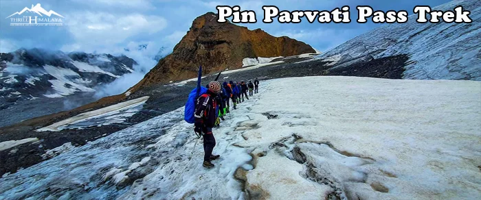
Duration: – 10 Nights & 11 Days Grade: – Difficult Physical Level: – Intermediate Season: – All year Around Locations: – Spiti Valley. Highest Altitude: – 17,450 ft
Day – 1
Getting to the Base Camp - Kaza: Take an overnight bus from Delhi and reach Manali the previous day. Pick up will be arranged from Manali at 6.00 am. The Rohtang and Kunzum passes are known for their notoriously bad traffic jams, making it all the more necessary to leave by 6.00 am. Drive out of Manali, and towards Batal via Rohtang pass on the Manali-Leh Highway. The road is not too good and is bumpy all through. From Gramphu, take a diversion towards the Gramphu – Batal – Kaza road. From Batal the route winds through the real Spiti Valley. Quaint little villages, tucked away in the mountains and arid mountains dotted with green and yellow patches of peas and barley fields. The route from here is straight out of a picture postcard. You will be camping along the Spiti river in Kaza. The acclimatization process starts today.
Day – 2
Acclimatization Day at Kaza:
Day – 3
Drive from Kaza to Mudh village; trek from Mudh to Tiya: From Kaza, drive down to Mudh village which is at a lower altitude. The drive will take you about 2 hours and covers a distance of 49km. Once you reach Mudh village start trekking to Tiya. You will reach Tiya in 2-3 hours. Mudh is a picture-postcard worthy village with white washed houses, peas and barley terraced fields. You can find guest houses here to accommodate trekkers trekking in Pin Valley. Pin Valley is known as snow leopard and ibex country. However, chances of spotting these animals on your trek remain elusive. It is important to start for Mudh from Kaza early as streams gets swollen later in the day, making it difficult to cross. Mudh is the last village you will see on this trek until Kheerganga on the second last day. This is also the only day of luxurious trekking - a very gradually ascending walk on scree and shale surrounded by barren yet colourful mountains typical of Spiti. The trails are well-defined with minimal chances of getting lost. You will be trekking along the Pin River through the day, moving upstream. The trekking trail is at a higher level than the river, so it won't be possible for you to fill water anywhere. However, to set up camp at Tiya, descend to the river bed. You will have limited level ground that is suitable for putting up tents. Across the river is Mangrungse - which is a campsite on Pin Bhaba trek.
Day – 4
Tiya to Shia: A long day for trekking with beautiful views of Spiti Valley. An early start is important to ford the multiple glacial streams today- which will leave your feet numb. A couple of these tiny streams are also drinkable. Starting on the left bank of the Pin river, the first section is an undulating walk on loose, sedimentary rocks. After this section, you descend to the river, cross it and ascend up the other side. There are a couple of tricky sections - narrow scree-laden ledges over the river that need navigating. After you've trekked some distance, the Pin Glacier becomes visible high up, in the distance. Shia is a shepherds' campsite with barely enough space for camping. You have to find space among the rocks and shale to set up camp. This is also a landslide prone area, so you have to be careful.
Day – 5
Shia to Pin Base Camp: Start your day by crossing the Pin river. You will have to remove your shoes. However, this is not easy to cross barefoot as there are a lot of stones and pebbles on the river bed. If the flow is strong and not manageable, you will have to go 2 km ahead and cross it over the glacier. The ascent to Pin Base Camp will leave you breathless. It is a steep ascent of 1,700 ft. There is also a tricky section that comes midway in the ascent- a stream crossing. This stream comes from Pin glacier (we will camp close to its glacial line) and the volume of the water is high. With the stream flowing on an incline, special care has to be taken while crossing it. The flow of the water is such that you can be swept down to the valley below. The team will have to be roped up for this section. Pin Base camp is a bare, rocky moonland below the Pin glacier and 1,000 ft below the Pass. The camp is also quite windy with views of rugged mountains all around - the setting is almost like Bhagwabasa campsite on Roopkund. These are very different mountains from the ones you see in Uttarakhand or the lower Himachal.
Day – 6
Pin Base camp to Mantalai via Pin Parvati Pass: Depending on the weather, an early start for the Pass is crucial. The Pass should not be traversed after noon as the weather always deteriorates in the second half of the day. The ascent to the Pass is tough, mainly because of the of the altitude - the glacier section is on a gradual incline. There are no crevasses to worry about on Pin side of the pass. The older and originally considered Pass can be seen to the left of the ridge. The Pass used nowadays is at a higher plane, above the one at the left. The world changes at Pin Parvati Pass! The bird’s eye view of both Pin valley and Parvati Valley is one of those grand views that stay with you. It is a very pretty panorama of both the valleys with unnamed peaks populating your view. You can see Parvati South Ridge, Snow Peak, Ridge Peak, Pyramid Peak, Kullu Makalu and Bara Shigri. You might even spot Kinner Kailash and Shrikhand Mahadev, if you know what to look for. The prayer flags fluttering- on your left- adds to the atmosphere at the Pass. Enjoy the view of lofty peaks from Kinnaur, Kullu and Spiti. You can also spot the Mantalai camp, far below, from the pass. The descent to Parvati glacier is brutal - it is sharp and crevasse-ridden. The snow hides these crevasses so you have to be extremely careful. Ensure the team follows the guides' instructions as he finds the path through the glacier, and descend in a single file. The glacier tapers off and becomes wetter and muddier, transforming into a scree laden plateau. Parvati Base Camp is similar to Pin Base Camp. The weather gets very cold here and the wind chill factor is high. It is a much better option to do a longer trek to Mantalai and have a rest day. The descent to Mantalai is steep and strewn with boulders which makes it a painful affair. Depending on the season, the trail can have snow. From here, you will see breathtaking views of the Parvati valley. You will also see many endangered species of plants and flowers, especially “Losars” and the “Brahmakamals”. Following the shepherds' trail, you will cross at least 2-3 mountain slopes before you reach Mantalai. At Mantalai, you will have to cross the ice-cold river barefoot and then proceed ahead along the river. Mantalai, said to be the source of Parvati river is not a conventional lake. The boundary of the lake is ill-defined and the area surrounding it is a marsh. The first signs of vegetation start from here - you might even find shepherds and a Baba living in a rock shelter. You will be able to see Pyramid Peak from its base to top and another unnamed peak on the other side. It is by far, the most beautiful and unique campsite you have come across on this trek.
Day – 7
Rest Day at Mantalai Lake: .
Day – 8
Mantalai Lake to Odi Thach campsite: This day consists of a scenic 9 km downhill hike all the way to the famous meadows of Odi Thach. Walk ahead, along the right side of the river bank, up to a moraine-filled ridge. Once you reach the top of the ridge, you get a view of the point from where Parvati river is gushing down. You have to climb down a series of huge scattered boulders after which it levels out to a valley walk. This is an easier day compared to others as most of it is in a valley section. Follow the trail on the right side of the valley till you reach a large ridge breached from the right side from where the River Parvati rushes down towards Mantalai. After traversing the first of the series of ridges, you officially exit the Mantalai region. The route towards Odi Thach swirls towards the left side of the valley and it becomes easily the prettiest day of the trek. The flowers near Odi Thach give you slopes which are completely decked in red, blue and purple colours. It really hits you, coming from the barrenness of Spiti valley. Every 100 metres after these slopes, you will feel like camping. The swamp land - with a very peaceful Parvati river which branches out to streams - culminates into a plateau and then goes through boulders till you reach level meadow - Odi Thach. A little ahead of Odi Thach is Jwari Thach where we camp.
Day – 9
Odi Thach to Tunda Bhuj: A difficult day like this one would surprise you at this stage after the trek to Odi Thach. It starts out gradually over the meadows and goes lower into the valley to the Parvati river through boulder -strewn fields and streams. You will see a series of waterfalls on your right side and Parvati river flows on your left. Notice Mt Kullu Eiger in front of you to your left along with some un-named peaks and glaciers surrounding the valley. Then you descend down to Pandu Pul which is a natural natural bridge over the river formed by large, misshapen boulders. This rock section can be tricky and slippery so be careful. During rains, one can rope the entire team for safety. You will have to climb down another rock jammed on top of a tributary of Parvati the same way before you head to out to an open valley with waist high shrubs to wade through. You will have to keep your eyes glued to the terrain as you will be walking on narrow ledges over the river. The pulley that takes you to Thakur Kuan is broken so you will have to stay on the same side of the river. This trail, however, gets tricky as it is overhanging the swollen Parvati river in many places. You cannot afford to make a mistake here. If the weather is not friendly, crossing this section will become dangerous. Once the tricky patch gets over, which is the only mountainous patch for today, you will enter forest a full of rhododendrons and pine trees. Tunda Bhuj campsite is a bowl on the mountain surrounded by cliff faces, higher up from the river. There are a series of waterfalls on these beautiful cliff faces and descending into mist. The lush greenery feels luminescent after the moonlands of Spiti. Pin Parvati is an experience that grows better after each campsite – with a layers of greenery adding on and following the various moods of the Parvati river.
Day – 10
Tunda Bhuj to Kheerganga: Today’s trek to Kheerganga is a steady descent to the gorge below where Parvati River is coming down at your right side. The trail will take you through many pasture lands, inside silver birch trees. You will also notice a series of lovely waterfalls on the huge mountain walls at the right side of the trail. These waterfalls, as they cascade down jagged mountain faces dissipate as mist. It is quite a sight. Start your day by crossing the bridge over a tributary of Parvati river. An abandoned hut can be located on the left side of the trail. The trail will swirl downhill, out of the expanses of Parvati Valley to an open pasture land. The first forest section – reminiscent of pine forests on Roopkund trail will be steep. Watch your step as it can get slippery with all the mud. After 30 minutes, you enter pastures again – full of knee high bushes and boulders. On your right, you will see local shepherds living in their tents. You can buy fresh buffalo milk from there at a reasonable rate. Ahead of you is a makeshift bridge that you have to cross – the second bridge for the day. After about 25 minutes of hike from here, the trail curves towards the left. You will find a small tent with locals selling refreshments – this is the first sign of civilisation after trekking through an entirely remote region. This is the first of many dhabas you will find near Kheerganga. From the pasture land, there is a meandering descent down to forest for 30 minutes that exits into another small open pasture land. From here, you descend down to the stream and crossover the last tributary for the day over a makeshift bridge. The trail ascends from the stream for about 45-50 minutes followed by a series of gradual incline and decline towards Kheerganga. You will reach Kheerganga by 1 pm and this is, frankly, one of the shorter days of the trek. Kheerganga is your last campsite and it feels like the end of the trek. There are many cafes in Kheerganga and you are not the only one pitching a tent there. With the music playing in cafes, civilisation has creeped into this beautifully remote trek. You can also take a bath in the hot springs of Kheerganga, which is a five star sauna experience at the end of long, tough trek. It is quite a luxury after an arduous trek like Pin Parvati!.
Day – 11
Kheerganga to Barshaini; depart from Barshaini: Trek for 7 km from Kheerganga to Barshaini. You will reach Barshaini around 11am. The trek ends at Barshaini. Indiahikes will arrange for transportation from Barshaini to Kullu. The cost of which will be additional and is to be paid to the drivers directly. It takes roughly 3 hours to reach Kullu. You can take the afternoon bus from Kullu to Delhi the same day. The trail enters a thick forest cover as you start the trek for Kheerganga. This region experiences lot of rainfall so expect the trail to be filled with excess mud on a rainy day. Since this is going to be a steep descent, remain alert as the trail can get slippery at times. It becomes a level walk after 40 minutes. Since Kheerganga is a popular trail, you will find dhabas on your way down. There will be a couple of streams running down the mountain on your right. They can be used for filling up your water bottles if needed. You will cross a makeshift bridge over River Parvati one last time today – and Parvati is a gushing, angry force now from the serenity it exuded from its source, Mantalai. Parvati River is quite the moody companion from Mantalai. Just 5 minutes ahead of the makeshift bridge is Rudranag. It is a small piece of land considered sacred, and has a temple dedicated Lord Shiva right next to it. There is a small waterfall next to it. The trail from here has its share of uphill and downhill walks and is manageable. About 30-45 minutes into the hike with Parvati river gushing below on your left side, you enter Nakthan Village. From Nakthan, the descent is steep – however, the trail is well laid, going through villages and lovely apple orchards down to an open meadow called Swagani Maidan. With a motor-able road all the way to Barshaini, very few travelers trek the old 12 km, 6 hour hike from Manikaran to Pulga which is said to be a scenic trail going beside the right bank of Parvati river, passing some small villages like Uchich village. Pulga has a Forest rest house build of pure teak wood where one can find accommodation to stay. You will reach Barshaini by 1 pm.
Day – 12
Buffer Day: .
The above quote includes:
Local guide for 7 days.
7 night accommodation in Hotel/tent.
Meals (07 pack lunch + evening tea + 06 dinner and 07 breakfast)
The above quote does not include:
Insurance of any kind (personal, medical, accidental etc.)
Items of personal nature such as beverages, laundry, phone bill, tips etc.
Emergency evacuation charges (if any).
Portage at railway stations and hotels.
Anything that is not mentioned under the “quote includes” head.


