Beas Kund Trek & Camping from Manali - 4 Days
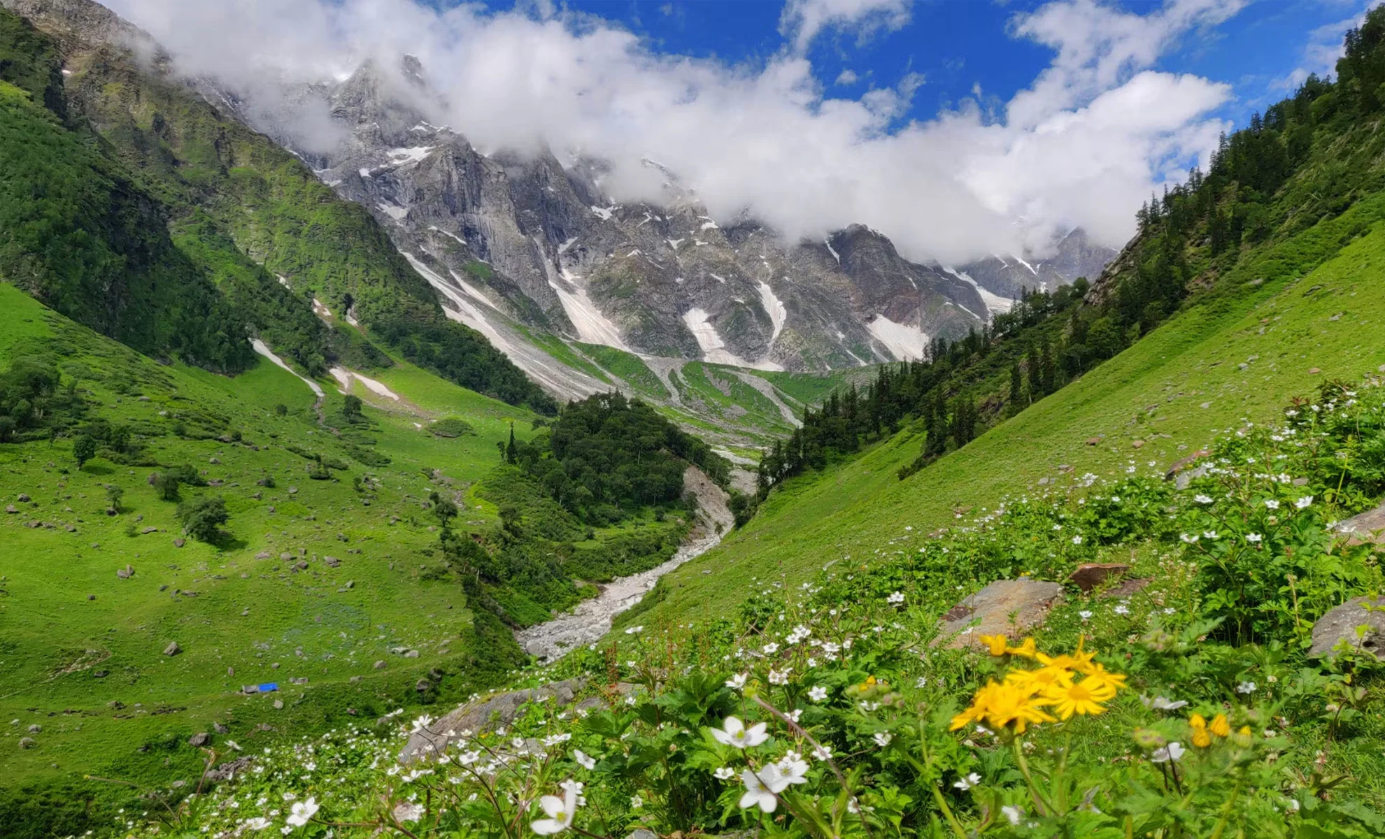
About Beas Kund Trek: Beas Kund has always been a famous trek around Manali. After all, it takes you right to the source of the river that flows through the town. You might have followed the very same river upstream while getting into Manali. But one of the reasons trekkers loves this trek is the setting. Picture this: Lush green grasslands flourish below the summits of the three biggest mountains around Manali. And hidden in these grasslands is the emerald lake out of which the river Beas emerges. The contrasting sight of this serene water body nestled in between jagged mountain peaks of the Pir Panjal range adds to the beauty of his setting. Standing here, there is also a keen sense of being near the source of the raging river you see in the valley below. This emerald kund branches off into streams, tumbling waterfalls right until it converges into the boiling Beas river. As is the case with every river that feeds a civilisation or settlements surrounding it, the Beas Kund is also associated with a legend. It is believed that Rishi Vyas, who wrote the Mahabharata took his daily bath in this lake. The term Beas Kund may have been derived from Vyas, the sage; and Kund, a lake. This combination of big snowy summits towering above you, the greenery of the grasslands, and the lake draw everyone to this trek. While this trek can be done by beginners, we would advise preparation. The climb from around 8000 ft at the beginning of the trek to over 12,000 ft is no mean feat.
Trek at a Glance
Duration : 3 Nights & 4 Days
Grade : Easy to Moderate
Physical Level : Intermediate
Season : May – October
Locations : Manali, Solang Valley, Dhundhi and Bakerthatch.
Highest Altitude : 12,772 ft
![]()
Day – 1 Drive from Manali to Dhundi. Trek from Dhundi to Palchhani Thatch (14 km / Duration: 1.5 hrs./ Altitude gain: 9,317 ft to 10134 ft)
Leave from Beas Bridge Manali, at 8.30 am. En route, drop your cloakroom bag and collect your rentals at Palchan. You reach your first campsite by 2.30 pm and have lunch there.
Day – 2 Palchhani Thatch to Lohali (4 km / Duration: 4 to 5 hrs./ Altitude gain: 10,134 ft to 11,050 ft)
The trail begins with a steep ascent as you head deeper into the valley. You'll find pine, birch and even some walnut trees. Around an hour into the trail, there's a stream that you have to cross. This also serves as a good water source. After crossing the stream the ascent continues followed by a steep descent. The trail is well marked with blue arrows painted on the boulders. So there's no possibility of getting lost. Further, from here, around 10-15 minutes into the trail, spot a log bridge that connects to the other side of the valley (i.e. Bakarthach campsite). This is just to get your bearings right. You will not be crossing the river at this point. Just stay on the same side of the river, on the right-hand side of the valley beside the Beas River. As you go further you will observe that the tree line has ended and subalpine bushes start. Around 1.6 km into the trek, the entire valley opens up and you can see the boulder sections from where the Beas River flows. You will also be able to see an Ice Wall above the Boulder Sections. Soon, the trail bends towards the right, into the valley. Once you're in the valley, you will see a stream flowing from the valley. Cross the stream and you have reached the next campsite Lohali. Lohali is a scenic campsite surrounded by mountains, it makes an ideal camping spot. Your water source here is the stream which flows beside the campsites.
Day – 3 Lohali to Lady Leg to Beas Kund and back to Lohali ( 5 km / Duration: 7-8 hours / Altitude gain: 11,050 ft to 12,772 ft and back)
Start early as you have to trek a height of around 1798 feet. With the distance being just around 1.6 km it’s a steep ascent to Beas Kund. The trail is well-marked and quite relentless. But the view of the mountains and forests around keeps you company. After around three hours of ascent, you will reach a meadow at an altitude of 12542 ft (3823m), this place is called Lady Leg, which also happens to be the summit camp of Friendship Peak. Rest here for a while and take some pictures. If the weather is clear, you'll get good pictures of Friendship Peak too. As you reach the Lady Leg campsite you will see a trail going to the left side of the meadow which goes all the way up to the highest point, which is on a ridge. It is a 15-20 minute climb from the Lady Leg Campsite. As you reach the ridge look for the lake in the distance. Note that, you won't be trekking to the banks of the lake but you can enjoy the views of it from the ridgeline On a clear day, you can catch a stunning view of Pir Panjal Range and Dhauladhar Range up close. Also major peaks like Hanuman Tibba, Shitidhar, Ladakhi and Friendship Peak stand majestically before you. On a really clear day, you can also see peaks like Deo Tibba and Indrasen down the valley. After spending some time at the summit, retrace your way to Lohali.
Day – 4 Lohali to Dhundi (4 km / Duration: 5-6 hours4 to 5 hrs./ Altitude loss: 11,050 ft to 9,317 ft)
Today’s trek is an easy one, you get back to Dhundi through the route you came up from. It takes 5-6 hours to reach Dhundi. and departure.
For Package Details, Please Call us at: (+91) 78310-50555, (+91) 98163-50555
Important Places to Visit In This Tour
I'am Interested! Please tell me the Best Offer!!
Package Includes
- All trekking arrangements including sleeping tents on twin sharing (Alpine shape), sleeping mattresses, sleeping bags, toilet tents, dinning tent (in case of a large group), kitchen tent, English speaking mountain guide, cook, kitchen helpers, camp boys, Mules for luggage.
Package Excludes
- Any bus, air or train fare before and after the tour.
- Any Hotel accommodation before and after the trek.
- Insurance of any kind (personal, medical, accidental etc.
- Items of personal nature such as beverages, laundry, phone bill, tips etc.
- Emergency evacuation charges (if any).
- Portage at railway stations and hotels.
- Anything that is not mentioned under the “quote includes” head
- GST 5% Extra


